Import Illinois Counties
Start SpaceStat. If you are already running SpaceStat, choose to start
a new project (File > New). Then, click the Import button  on the Projects
toolbar and select "Polygon or point file." You may also
go to File -> Import -> Polygon or point file.
on the Projects
toolbar and select "Polygon or point file." You may also
go to File -> Import -> Polygon or point file.
-
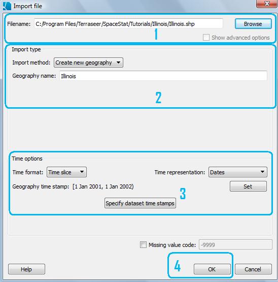
Browse to Illinois.shp, in the IL folder, in the Program Files/Biomedware/SpaceStat/Tutorials folder.
-
First you need to select the import type, but this is easy because you have just opened a new project, so your only option under "Import method" will be to create a new geography. The default name SpaceStat gives to the geography will match the shapefile, but you can change the name in the box marked "Geography name".
-
The time stamp we will apply to the county geography will be a time slice with a start and end values that matches the years of the population data. So, choose "time slice", and then choose "dates" as the time format. Next, click on the "Set" button, and change the start from the default (1-1-2001) to 1-1-1990. Leave the "inclusive" box checked. Then fill in 1-1-2021 for the end date, and leave the "inclusive" button unchecked. SpaceStat will interpret this as meaning that the time slice ends at the very end of the year 2020. Click OK to close the time stamp dialog, and then check that the dates that appear after "Geography time stamp" match those shown below.
-
Click OK. Then SpaceStat will import the Illinois geography.