In an era of rapidly expanding data and ever-shifting landscapes—both physical and digital—the ability to make sense of where things occur, when they occur, and why they occur has become ever more critical. That’s the realm of geospatial analysis: a set of tools, methods, and mindsets centered on spatial (and often temporal) data, which help us map, model, monitor, and understand the world around us.
At its core, geospatial analysis asks the four W-questions: “What, Where, When, and Why.”
- What is being observed (disease incidence? land-cover change? wildlife movement?)
- Where does it occur (point, region, across landscapes?)
- When did it occur (snapshot? trend over time?)
- Why does it happen (underlying spatial processes, human-environment interactions?)
In this blog, we will unpack what geospatial analysis is, its key components, the kinds of data and methods used, why it matters across domains (from business to environment to public health), and some practical considerations for leveraging it effectively.
What is Geospatial Analysis?
Geospatial analysis refers to the processes and techniques by which spatially referenced data are collected, processed, visualized, analyzed, and interpreted. It leverages geographic information systems (GIS), remote sensing, spatial statistics, time-series analysis, and often modelling of spatial processes.
I like this definition:
“Geospatial analytics gathers geographic information system (GIS) data from multiple types of technology to help you understand environmental, demographic, and topographic trends.”
Hence, geospatial analysis is more than just making maps: it’s about deriving insight from space-time data, understanding patterns, clusters, trends, and relationships across geography and over time.
Geospatial Analysis and Its Relationship to GIS
A geographic information system (GIS) is one of the foundational tools enabling geospatial analysis: storing, managing, querying, visualizing spatial data, and often supporting analysis and modelling. But geospatial analysis goes further: it builds on GIS plus statistical modelling, temporal dynamics, predictive analytics, and interpretation of spatial behaviour.
For example, many of us use GIS technologies daily (e.g., navigation apps), often without thinking of them as “geospatial analysis”.
Key Elements Of Geospatial Analysis: Space and Time
Two critical dimensions in geospatial analysis are space (location, geography) and time (temporal changes). Modern applications increasingly treat space and time jointly (“space‐time” analysis) rather than as separate considerations. For example, mapping disease spread across regions and across months or years. The concept of a “space-time data set” underlies much of the innovation in this field.
Why “What, Where, When, Why” Matters With Geospatial Analysis?
Mapping alone of the What, Where, and When doesn’t suffice. The real payoff is the Why.
Why do patterns on your maps arise (what causal processes, mechanisms or external drivers)? Without answering the why, you’re left with descriptive maps but not actionable insight.
The Building Blocks of Geospatial Analysis
To conduct geospatial analysis, one must assemble multiple elements. These include:
Data (Spatial, Temporal, Attribute)
- Spatial data: Location information (coordinates, boundaries, networks, rasters).
- Temporal data: Time‐stamps, sequences, trends.
- Attribute data: The “what”-information (e.g., pollutant concentration, disease case count, land-cover class).
For example, see this article on geospatial data collection that describes methods for recording data across individuals, populations, environments—covering both spatial and temporal attributes.
Techniques & Methods
Some of the most commonly used methods:
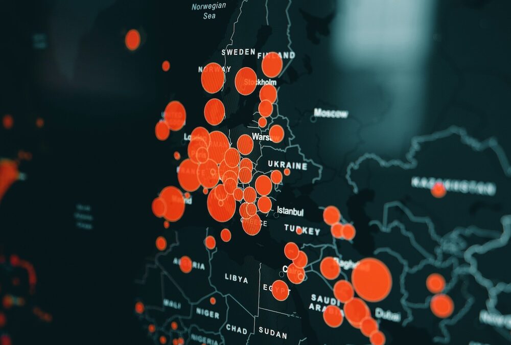
- Mapping and visualization (choropleth, isopleth, heatmaps)
- Spatial statistics (cluster detection, hot-spot analysis, Moran’s I)
- Interpolation and geostatistics (kriging, co-kriging)
- Space-time modelling (trend detection, joinpoint regression)
- Remote sensing and change-detection
- Network analysis, proximity and accessibility modelling
This blog on “4 Space‐Time Data Visualization Techniques” gives a practical view of how visualization and statistical graphics are used to explore spatial data.
Scale, Support, and Granularity
Spatial scale (grain, extent) matters a lot: the size of the geographic unit, and the resolution of data can drive different conclusions. Temporal scale matters too: Are you investigating changes monthly, annually, or over decades?
Interpretation & Causality
Perhaps the most challenging part: interpreting why patterns occur and moving toward causality or predictive insight. Visualizing clusters is one thing; understanding the mechanisms is another. The progression from visualization → hypothesis generation → statistical modelling → inference is critical.
Tools and Platforms
Modern geospatial analysis relies on GIS software (ArcGIS, QGIS), remote sensing platforms, spatial‐statistical tools (R sp, sf, gstat, Python’s geopandas, rasterio), and specialised platforms such as BioMedware’s own product Vesta (Visualization & Exploratory Space‐Time Analysis).
Why Does Geospatial Analysis Matter?
Geospatial analysis is not a niche activity — it has broad relevance across business, public health, environment, infrastructure, and policy. Here are some key reasons:
Better Decision-Making Through Place & Time
Decisions often involve where and when. Whether it’s selecting a retail store location based on customer catchment areas, modelling disease spread based on neighbourhoods, or tracking deforestation, the spatial and temporal dimensions matter critically.
Environmental & Public Health Applications
For example:
- Monitoring deforestation, land-cover change, climate impacts using satellite and GIS tools.
- Mapping disease incidence, exposure‐reconstruction (exposome), and linking environmental exposures to health outcomes.
- Urban planning, disaster management, and habitat conservation all rely on spatial and space-time data.
Business & Infrastructure Use Cases
Retail chains use drive-time maps and location analytics; logistics companies use network modelling; real-estate developers use spatial clustering; telecoms use spatial optimization. The link between location and value is increasingly recognized.
Strategic Insight & Predictive Analytics
Beyond “what has happened” to “what might happen” is becoming possible with geospatial modelling. For example, identifying hotspots, early warnings, emergent clusters, and scenario modelling over space-time. The emphasis is on forecasting built on a strong “understanding of the now” as well as past trends.
5 Practical Considerations & Challenges With Geospatial Analysis
As powerful as geospatial analysis is, there are several practical hurdles and caveats to watch out for:
- Data Quality, Resolution, and Scale: Poorly geocoded data, mismatched spatial units, coarse resolution, and inconsistent temporal intervals all degrade analysis quality. As noted earlier, the choice of scale can impact interpretation.
- Privacy, Ethics, and Consent: Especially when individual‐level location data or health data is involved, privacy risks are real. There are four major concerns: personal identifiability, data collection without consent, third-party sharing, and government/law-enforcement use.
- Causality versus Correlation: A mapped spatial cluster doesn’t automatically imply causation. Without understanding underlying processes (why), one risks misinterpretation. Visualization must be complemented by hypothesis generation and modelling.
- Technical & Analytical Capacity: Working with spatial and temporal data often requires specialized skills (GIS, remote sensing, spatial statistics). Organisations need people, processes, and tools in place.
- Scale & Complexity: As data volumes grow (satellite imagery, IoT sensors, mobile devices), big data and real‐time analytics raise new challenges in storage, computation, and algorithm design.
How To Get Started With Geospatial Analysis
For organizations or analysts new to geospatial analysis, here is a high-level “starter” roadmap:
- Define the question: What is the problem, what spatial/temporal dimension matters, and what is the geographic extent?
- Identify and gather data: Acquire spatial datasets (points, polygons, rasters), temporal stamps, attribute data; assess quality and resolution.
- Choose the right scale/units: Carefully select spatial granularity (county, census tract, grid) and temporal aggregation (daily, monthly, yearly).
- Exploratory visualization: Generate maps, plots to inspect patterns and generate hypotheses (visualize → hypothesis).
- Analytical modelling: Apply spatial statistics, cluster detection, interpolation, trend detection, and perhaps predictive modelling.
- Interpret and act: Derive actionable insight tied to the “why”. Translate findings into decisions, interventions, and policy.
- Communicate results: Use maps, dashboards, story-maps, and visualizations to convey spatial patterns to stakeholders.
- Evaluate and iterate: Validate results, refine scale, and update as new data come in.
Real-World Examples Of Geospatial Analysis
Here are two brief examples to illustrate how geospatial analysis is used in practice:
- Environmental Monitoring: Geospatial tools have been used to track deforestation, monitor air and water pollution, wildlife habitats, and link environmental change to human health.
- Public Health & Longevity Clusters (“Blue Zones”): Geospatial analysis has been used to identify clusters of extreme longevity (so-called “Blue Zones”), leveraging spatial epidemiology, cluster analysis, and remote sensing to map areas where individuals routinely live into their 90s or 100s.
These examples underscore how geospatial analysis cuts across domains—environmental science, health, infrastructure, and business.
Future Trends In Geospatial Analysis
Looking ahead, a number of emerging trends are shaping the future of geospatial analysis:
- Integration of AI/ML in spatial analytics: combining spatial data with deep learning for object detection, pattern recognition, and predictive modelling.
- Real-time and streaming spatial data: sensors, mobile devices, and IoT devices generating continuous location-based data.
- Cloud GIS / Edge computing: Handling large geospatial datasets in real time at scale.
- Improved space-time modelling: More sophisticated methods to capture change across space and time simultaneously.
- Greater emphasis on ethics, data governance, and privacy as spatial data increasingly touches individuals.
- Cross-disciplinary applications: Urban analytics, smart cities, precision agriculture, climate-change adaptation, health equity mapping—all leveraging geospatial analysis.
Transform Your Work With Geospatial Analysis
Geospatial analysis is a powerful lens through which we can view, interpret, and act upon the complex interplay of location, time, and context. It transforms raw spatial, time-stamped data into actionable insight—whether for business location strategy, public-health planning, environmental monitoring, or infrastructure management.
The key is not just to “make maps” but to ask why things occur where and when they do—and then use that insight to drive smarter decisions. As geospatial data proliferates and analytic capabilities advance, the opportunity is enormous—but so is the need for thoughtful implementation: the right scale, the right methods, the right ethical guardrails.
If you’re embarking on a geospatial analysis journey—whether for environmental monitoring, business intelligence, or health research—start with a solid question, assemble your spatial and temporal data carefully, leverage visualization to explore, and build models that move from description to prediction to action.
Want to give geospatial analysis a spin? Download a free trial of the Vesta software and analyze one of the sample datasets included with the software.