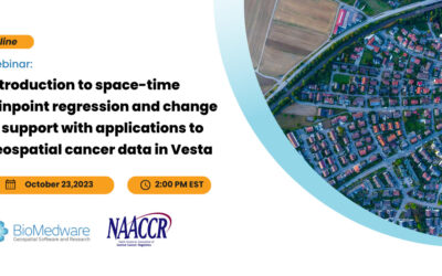
BioMedware Partners With NAACCR: Space-Time Analysis and Modeling Webinar
Introduction to space-time joinpoint regression and change of support with applications to geospatial cancer data in the Vesta software Oct. 23, 2023 | 2pm EST | Virtual BioMedware is teaming up with NAACCR for a webinar on October 23 titled, “Introduction to...

Dr. Pierre Goovaerts to Present at IEA and LSUS Conference on Environment
Dr. Pierre Goovaerts to Present at the 28th International Interdisciplinary Conference on the Environment Oct. 19-21, 2023 | Virtual Dr. Pierre Goovaerts will present a talk titled: "Geospatial Estimation of the Impact of Deepwater Horizon Oil Spill on Plant Oiling...

BioMedware receives new grant for modeling human exposures and their uncertainty
In September 2023, BioMedware’s Chief Scientist, Dr. Pierre Goovaerts, received the grant “Geostatistical Software for Non-Parametric Geostatistical Modeling of Uncertainty”. Funded by the National Library of Medicine of the National Institutes of Health, this new...

Kriging vs Co-Kriging: Understanding Two Data Interpolation Methods
Geostatistics—a branch of statistics tailored for spatial data analysis—has seen significant advancements in recent years. Kriging and Co-Kriging are popular geostatistical techniques for spatial interpolation and prediction. These methods are essential in various...

Missing Data Part II: The Saga Continues
Our team recently published a blog on missing data and how it can be handled in GIS applications such as Vesta. This topic resonated with several of our readers, who raised important points we would like to discuss further. The first blog observed that missing data...

BioMedware’s Experience with Digital Summer Clinic Interns: Path to Success
Together with Ann Arbor SPARK, the Eastern Michigan University Center for Digital Engagement offers a paid Digital Summer Clinic internship. This program helps students and recent graduates find careers in the digital space. These internships are available to all...
The Power of Scaling: How It Alters Map Interpretation and Impacts Data Analysis Accuracy
Maps play a crucial role in representing spatial information, allowing us to visualize and analyze data in a geospatial context. However, one critical aspect that significantly influences the interpretation and accuracy of data analysis on maps is its level of detail...

7 Features to Consider Before Purchasing a GIS Solution
Not all GIS software is created equal. When deciding on which GIS software to purchase, there are several things you should look for. #1 Purpose What will you be using the software for? Think about the application area first, such as spatial health analysis, climate...
The National Cancer Plan of 2023
Recently the National Cancer Institute released its National Cancer Plan which provides a comprehensive framework to develop cancer control strategies, share knowledge, and accelerate progress. The overall objective is to end cancer as we know it; a target that has...

BioMedware Space-Time Analysis Workshop At Louisiana State University
Louisiana State University Shreveport (LSUS) and BioMedware are pleased to announce a workshop providing FREE in-person training on BioMedware software for GIS data. The software is used for the visualization, analysis, modeling, and interactive exploration of...