
I can see the pattern — but what does it mean?
You’ve spent hours assembling your data. You geocoded the records, loaded the basemap, and produced a choropleth. The cluster is apparent — but you don’t know whether it is real or random, growing or fading, or what is driving it. You have a map. You lack an answer.
That gap between seeing a pattern and understanding the process behind it is where most spatial analysis tools stop. It is exactly where this guide begins.
Spatial analysis is not a mapping exercise. It’s an epistemological one: a systematic method for turning location-referenced data into knowledge. Done well, it answers not just what and where, but also when and why — the questions that drive decisions, inform interventions, and advance knowledge.
This guide defines spatial analysis at its full depth, explains why most tools deliver only a fraction of it, and describes what a complete spatial analysis capability looks like in practice.
Why Does Spatial Analysis Matter?
Every observation — a disease case, a retail sale, an animal outbreak report, an insurance claim, a soil contaminant reading— exists somewhere, at some time, and for some reason. Spatial analysis is the discipline that takes those dimensions seriously. At BioMedware, we organize spatial analysis around four fundamental questions, which we call the 4 W’s:
- What is being observed? Disease incidence, species occurrences, contamination concentrations, and livestock density. The observation defines the question.
- Where does it occur? Location is the anchor that connects your data to the real world.
- When does it happen, and how does it change over time?
- Why did it happen, and what underlying processes produced the pattern? This is inference. This is knowledge. This is the goal.
A tool that answers only What and Where gives you a description. One that answers all four gives you understanding. The difference determines whether your analysis informs a decision or is a mere illustration.
The stakes are clear in all domains. In veterinary epidemiology, knowing where an African swine fever outbreak has been detected is the starting point; knowing why it is spreading in that direction, and when transmission rates are accelerating, is what drives containment decisions. In cancer epidemiology, a cluster on a map raises a question; inference about environmental risk factors and temporal trends is what answers it.
Spatial analysis matters because the Why matters. And reaching the Why requires tools built for inference, not just visualization.
What Can Spatial Analysis Tools Do?
Not all tools marketed as spatial analysis platforms deliver appropriate capabilities. Understanding the capabilities you need is the first step in selecting the right software.
Cluster Detection and Statistical Significance Testing
A cluster visible on a map may be real, or it may be an artifact of population density, reporting variation, or chance. Full spatial analysis tools include formal cluster detection methods that assess whether an apparent concentration of events is statistically significant, accounting for the underlying population at risk. Without this, you cannot distinguish signal from noise.
Space-Time Modeling
Time is not optional in spatial analysis — it’s structurally necessary. A spatial pattern observed at a single point in time is ambiguous: you cannot tell whether it reflects an active process, a historical artifact, or a spurious concentration. The film tells you what the snapshot cannot.
A growing disease cluster implies active transmission and demands immediate intervention; a long-standing one points to a persistent environmental exposure; a declining one suggests a completed event. Each implies a different response. The underlying processes that produce spatial patterns — purchasing behaviors, disease transmission, environmental contamination, population migration, AMR spread — unfold across both space and time. Appropriate spatial analysis tools handle the time dimension natively, not as an afterthought.
Inferential Outputs with Uncertainty Quantification
A map is not an inference. Inference requires a method that produces an output with a quantified level of confidence, such as a significance test, a credible interval, or a variance surface. Tools that produce only visual outputs leave the analyst to carry the inference mentally, with no basis for separating real effects from random variation.
Analysis-Result Mapping
The outputs of spatial statistical analysis — cluster boundaries, regression coefficient surfaces, model residuals, prediction uncertainty maps — are themselves spatial. They should be mapped, not tabled. A platform that runs the analysis but leaves results in a spreadsheet has broken the analytical pipeline at the moment it matters most.
Spatial Analysis vs. GIS: What’s the Difference?
Geographic Information Systems (GIS) and spatial analysis are related but distinct. GIS is the foundational infrastructure for spatial work: it organizes location-referenced data, manages coordinate systems and projections, enables spatial queries and overlay operations, and produces maps. It is powerful, essential, and widely used. But GIS spatial analysis, as typically practiced, has structural limits.
Where Does GIS Spatial Analysis Stop?
GIS was built to manage and display spatial data — to answer What and Where. Its analytical functions, such as buffer analysis, overlay, proximity calculations, and basic choropleth mapping, are powerful for those questions. But GIS spatial analysis typically does not do any of the following:
- Formally account for spatial autocorrelation: The statistical dependence between nearby observations that violates standard assumptions and inflates apparent significance
- Model spatial non-stationarity: The reality that relationships between variables often vary across space rather than remaining constant globally
- Handle the time dimension analytically: Most GIS platforms treat time as an attribute, not a statistical dimension
- Produce inferential outputs with uncertainty quantification: The significance tests, confidence surfaces, and formal hypothesis tests that distinguish signal from noise
This is not a gap that better GIS training closes. It is a consequence of what GIS was built to do. Closing it requires methods specifically designed for spatial and space-time inference. For a deeper exploration, see our post What Is Geospatial Mapping? How Does It Work?.
6 Spatial Analysis Methods That Go Beyond GIS
Six methods represent the analytical core of full spatial analysis. Each produces not just maps but inferences — formal conclusions about the structure, significance, or underlying process behind a spatial pattern. Each produces outputs that are intrinsically spatial and should be mapped.
1. Cluster Detection — Is the Pattern Real or Random?
Cluster detection algorithms, such as the Cuzick-Edwards test, BioMedware’s Q-statistics, and scan statistics, assess whether an observed concentration of events is statistically significant given the underlying population at risk.
The output is a formal test: is this cluster consistent with random variation, or does it exceed what chance would produce? The result is a significance surface — cluster membership, significance level, and intensity encoded spatially — giving the analyst a geographically explicit answer to their most fundamental questions.
2. Spatial Autocorrelation — What Is the Structure and Scale of the Pattern?
Spatial autocorrelation analysis (Moran’s I, local indicators of spatial association, variograms) quantifies the degree to which nearby observations are more similar to each other than chance would predict.
It matters for two reasons: spatial autocorrelation violates the independence assumptions of standard statistical methods, inflating significance; and its scale and structure reveals how far the underlying process extends and whether it operates smoothly or discontinuously across space.
3. Geographically Weighted Regression (GWR) — How Do Relationships Vary Across Space?
Where standard regression produces global coefficients, GWR estimates local coefficients at each observation location — a surface that shows where a risk factor matters more, where it matters less, and where its relationship to the outcome reverses. GWR model fit (R²) surfaces reveal where the model explains outcomes well and where something unmeasured remains at work.
4. Kriging and Spatial Interpolation — Prediction with Honest Uncertainty
Kriging estimates values at unsampled locations based on the spatial structure of the data, producing not just a predicted surface but a variance surface — a map of uncertainty quantifying how confident the predictions are at each location. High-variance zones flag where additional sampling would most improve the model. Together, the two surfaces give the practitioner a complete, honest picture of what is known and what is not.
5. Joinpoint Regression — When and Where Do Temporal Trends Change?
Joinpoint regression identifies points in time when a trend changes significantly, like when an increasing rate begins to fall, a declining trend reverses, or an acceleration begins. Applied spatially, it reveals not just when trends change but where those changes occur, where they are strongest, and where they lag. It is the formal tool for distinguishing meaningful change from random fluctuation.
6. Machine Learning Regression — Risk Factor Importance Across Complex Landscapes
Methods such as Random Forest and gradient-boosted regression estimate the relative importance of risk factors across complex, nonlinear, high-dimensional landscapes where standard regression assumptions are violated. Their outputs — variable importance maps, predicted risk surfaces, residual maps — are spatial, and they guide the formulation of hypotheses that more formal inferential methods can then test.
3 Examples of Spatial Analysis By Industry
Veterinary Epidemiology
Tracking ASF across pig-dense provinces requires cluster detection to identify active transmission hotspots, GWR to understand how pig density and movement patterns modulate risk, and joinpoint regression to detect when spread rates are accelerating. Machine learning models using WAHIS outbreak data alongside GLW4 livestock density surfaces identify the highest-risk communes for proactive surveillance deployment. This work — mapping analysis results, not just data — is what turns surveillance into intervention. See our veterinary epidemiology industry page for more.
Spatial Epidemiology
Investigating elevated disease incidence near an industrial site requires cluster detection to establish statistical significance, GWR to test whether proximity predicts incidence after controlling for demographics, and kriging to interpolate exposure surfaces with honest uncertainty quantification. Residual maps reveal where the model fails — pointing toward unmeasured confounders the next phase of investigation must address. See our spatial epidemiology industry page for more.
Cancer Epidemiology
Spatial analysis of cancer registry data encompasses cluster investigation overlaid with EPA toxic release and Superfund site data, joinpoint regression of mortality trends, GWR analysis of screening access gaps against late-stage diagnosis rates, and environmental justice analysis combining CDC Social Vulnerability Index data with cancer burden estimates. Each analysis produces outputs that reach their full decision-support value only when mapped. See our cancer epidemiology industry page for more.
The #1 Challenge of Spatial Analysis Platforms: The Data Gap
The most consistently cited barrier to effective spatial analysis is not the complexity of the methods — it is the time and effort required to assemble usable data before analysis can begin. Survey findings from our user research confirms what practitioners already know: data cleaning and formatting consume more analyst time than the analysis itself.
The structural problem is that the data sources that feed spatial analysis — WAHIS, CDC WONDER and PLACES, Census ACS, NARMS, EPA air quality monitoring, FAOSTAT — were never designed to work together. They use different geographic units, different temporal resolutions, and different file formats. Assembling them requires downloading CSVs, cleaning inconsistent formats, geocoding records, harmonizing geographic boundaries, and resolving mismatches in spatial scale.
That last challenge has a formal name: change of support. When data are at different spatial scales — county-level incidence rates alongside census-tract demographic data alongside point-level outbreak records — integrating them analytically requires methods that account for the scale differences, not just a join on a shared identifier. Most tools leave this to the analyst. It is a significant source of analytical error and wasted time. For a deeper look at data sources, see our post 9 Effective Geospatial Data Collection Methods.
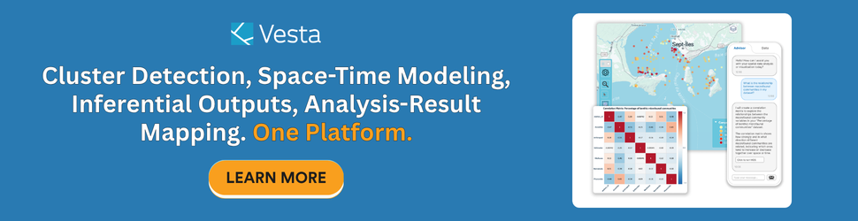
Vesta: Spatial Analysis Across All Four W’s
BioMedware built Vesta on a specific premise: that the full depth of spatial analysis — from data import through inference through the spatial rendering of analytical results — should be accessible to the domain expert without requiring that expert to also become a GIS specialist, a statistician, and a data engineer.
The Vesta AI Advisor is the thread that connects the four W’s into a single guided workflow. Describe your research question in plain language. The Advisor identifies the relevant data sources, proposes an ordered analysis plan, retrieves and structures the data, walks you through method selection with statistical caveats flagged before the model runs, and guides interpretation of results. It does not replace the analyst’s domain expertise — it handles the spatial statistics so the analyst can focus on the problem.
Vesta closes the six analytical gaps that GIS leaves open, including the data gap described above. Direct import pipelines pull from WAHIS, CDC, Census ACS, NARMS, FAOSTAT, and other surveillance sources — automatically cleaned, structured, and change-of-support handled — so the analyst starts at the analysis, not the data preparation.
Critically, Vesta maps analysis results, not just data. Cluster significance surfaces, GWR coefficient and model-fit maps, residual maps, kriging prediction and uncertainty surfaces — all rendered spatially within the platform. The inference becomes spatial. The Why becomes visible. The full chain — from What through Where and When to Why — in one platform, guided by AI, accessible without GIS specialization.

Find Your Next Spatial Analysis Platform
Full spatial analysis — cluster detection, GWR, kriging, joinpoint regression, machine learning regression, space-time modeling, and the spatial rendering of inferential outputs — is what moves from description to knowledge. It turns a map of cases into an understanding of transmission dynamics, a map of incidence rates into an investigation of environmental causation, a surveillance dataset into a forecast of where the outbreak goes next.
Spatial analysis matters because the Why matters. And reaching the Why requires tools built for inference, not just visualization.
Download Vesta free and see what full spatial analysis looks like in practice, or contact us to schedule a demo.
Frequently Asked Questions About Spatial Analysis
What is the difference between GIS and spatial analysis?
GIS (Geographic Information System) is the technology infrastructure — the software, data model, and mapping engine — used to manage, visualize, and perform basic operations on spatial data. Spatial analysis applies statistical and computational methods to produce formal inferences about patterns and underlying processes.
What is space-time analysis and why does it matter?
Space-time analysis models how spatial patterns change over time and uses those changes to infer the underlying processes at work. It matters because the processes that produce spatial patterns — disease transmission, environmental contamination, population change — unfold across both space and time.
What is spatial inference?
Spatial inference is the use of formal statistical methods applied to location-referenced data to draw conclusions about the structure, significance, and underlying causes of spatial patterns.
What is the difference between a spatial pattern and a spatial process?
A spatial pattern is what you observe: a concentration of disease cases, a gradient of soil contamination, a cluster of outbreak reports. A spatial process is the mechanism that produces the pattern: disease transmission, pollution dispersion, and farm network connectivity.
What tools can perform full spatial analysis beyond basic GIS mapping?
Full spatial analysis includes cluster detection, spatial autocorrelation analysis, GWR, kriging, joinpoint regression, and space-time modeling, among others. BioMedware’s Vesta platform integrates these methods with an AI Advisor that guides users from data import through analysis through the spatial mapping of results, without requiring GIS specialization.