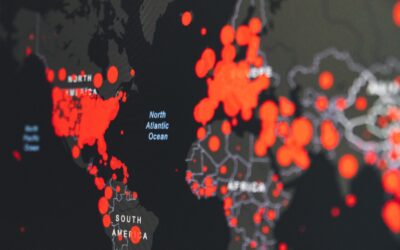
Almost There!

Please enter your information below and proceed to download Vesta.

Available for Windows 10 or later. macOS coming soon.

Download Vesta
  • Vesta
    • Features
    • AI Advisor
    • Data Security
    • Data Preparation
    • Pricing
    • User Account
    • Documentation
  • Industries
    • Cancer Epidemiology
    • Veterinary Epidemiology
    • Spatial Epidemiology
  • Blog
  • About Us
    • Leadership
    • Past Research
    • Current Research
    • Collaborations
    • Contact Us
  • Resources
    • Support Request
    • Published Research
Try Free Buy Now

Geospatial Data & Analysis Posts

  • News
  • Geospatial Data & Analysis
  • GIS Technology
  • Learn
  • Public Health
Perils of Pareidolia and AI: Can AI find disease clusters?

Perils of Pareidolia and AI: Can AI find disease clusters?

by Geoffrey Jacquez, Ph.D. | Nov 27, 2023 | Geospatial Data & Analysis, Learn with BioMedware

A major problem in the geospatial analysis of health events is identifying “true” excesses in health outcomes and disease risk. Most cancers, for example, occur at a “background” rate, often due to the underlying DNA mutation rate. This background mutation rate is...

Vesta 2.0: The Latest Advancement in Geospatial Analysis

Vesta 2.0: The Latest Advancement in Geospatial Analysis

by Geoffrey Jacquez, Ph.D. | Nov 8, 2023 | BioMedware News, Geospatial Data & Analysis

BioMedware is delighted to announce the release of Vesta 2.0, a state-of-the-art geospatial analysis software funded with grants from the National Cancer Institute and the National Institute for Environmental Health Sciences. Vesta is an acronym for “Visualization and...

Kriging vs Co-Kriging: Understanding Two Data Interpolation Methods

Kriging vs Co-Kriging: Understanding Two Data Interpolation Methods

by Pierre Goovaerts, Ph.D. | Oct 3, 2023 | Geospatial Data & Analysis

Geostatistics—a branch of statistics tailored for spatial data analysis—has seen significant advancements in recent years. Kriging and Co-Kriging are popular geostatistical techniques for spatial interpolation and prediction. These methods are essential in various...

Missing Data Part II: The Saga Continues

Missing Data Part II: The Saga Continues

by Geoffrey Jacquez, Ph.D. | Sep 6, 2023 | Geospatial Data & Analysis

Our team recently published a blog on missing data and how it can be handled in GIS applications such as Vesta.  This topic resonated with several of our readers, who raised important points we would like to discuss further.  The first blog observed that missing data...

The Power of Scaling: How It Alters Map Interpretation and Impacts Data Analysis Accuracy

The Power of Scaling: How It Alters Map Interpretation and Impacts Data Analysis Accuracy

by Pierre Goovaerts, Ph.D. | Jul 25, 2023 | Geospatial Data & Analysis

Maps play a crucial role in representing spatial information, allowing us to visualize and analyze data in a geospatial context. However, one critical aspect that significantly influences the interpretation and accuracy of data analysis on maps is its level of detail...

The Change of Spatial Support

The Change of Spatial Support

by Pierre Goovaerts, Ph.D. | Apr 17, 2023 | Geospatial Data & Analysis

In geostatistics, a spatial support refers to the size and shape of the area or volume over which a variable of interest is measured or observed. Examples of spatial support include the volume of a soil core analyzed to measure pH, the pixel size in satellite imagery,...

What is the Difference Between Geostatistics and Geospatial Analysis?

What is the Difference Between Geostatistics and Geospatial Analysis?

by Pierre Goovaerts, Ph.D. | Apr 5, 2023 | Geospatial Data & Analysis

Geostatistics and geospatial analysis are related concepts, but they refer to different aspects of spatial data analysis. Let’s take a look at the difference between geostatistics and geospatial analysis and how these two concepts work together.  What is...

Rapid Visualization Using Statistical and Cartographic Brushing

Rapid Visualization Using Statistical and Cartographic Brushing

by Geoffrey Jacquez, Ph.D. | Mar 10, 2023 | Geospatial Data & Analysis

In our fast-paced world, rapid analysis is essential to reach plausible explanations with known amounts of certainty.  Researchers have previously identified endeavors where Vesta provides forecasting and an understanding of the current determinants. Vesta offers...

Why is Geospatial Analysis Important?

Why is Geospatial Analysis Important?

by Geoffrey Jacquez, Ph.D. | Nov 25, 2022 | Geospatial Data & Analysis

Geospatial analytics gathers geographic information system (GIS) data from multiple types of technology to help you understand environmental, demographic, and topographic trends. But you may be surprised to learn that you use GIS technology in your daily life. Let's...

6 Industries Where Geospatial Data is Essential

6 Industries Where Geospatial Data is Essential

by Pierre Goovaerts, Ph.D. | Nov 23, 2022 | Geospatial Data & Analysis

Contrary to popular belief, geospatial data is all around us. So much so that it’s difficult to think of data that is not geospatial.  Geospatial data arises whenever events occur at specific geographic locations, such as disease cases in a specific area. Think of...

« Older Entries
Next Entries »

PO Box 64
Saline, MI 48176

Phone & Fax: (734) 913-1098

  • Contact Us
  • Blog
  • Testimonial
  • Subscribe
  • Privacy Policy
  • Accessibility
  • Industries

© BioMedware, Inc.

Privacy Policy